Smart Mobility Platform
Map & Navigation platform for the rapid implementation
of city traffic management systems and developing city apps
Why use the Smart Mobility Platform from Sygic?
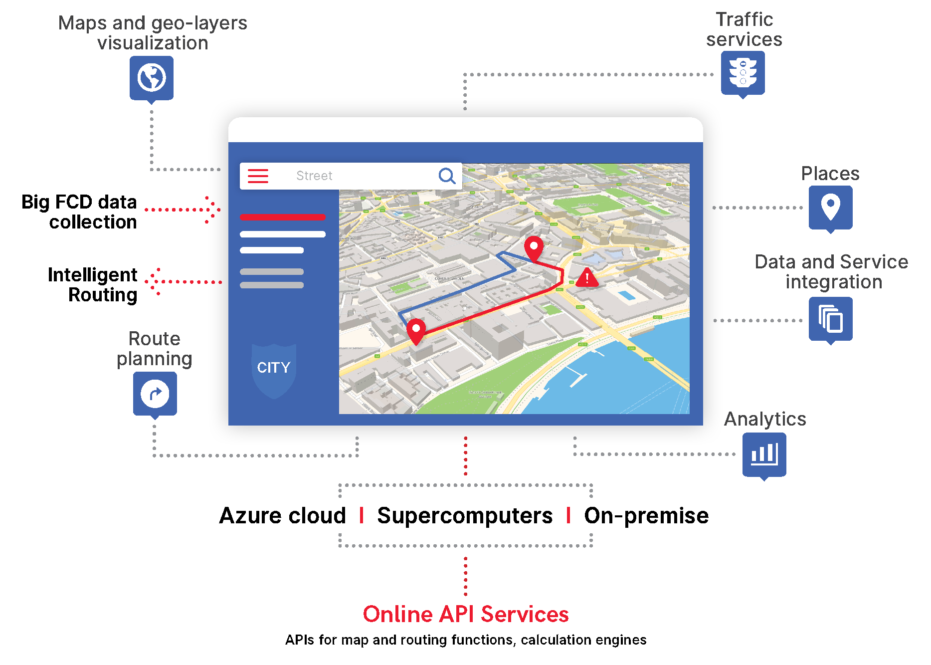
Big data collection, processing and service integration
Data fusion from floating car data, road sensors, parking and more to understand traffic in your city.
Ready for MaaS implementation
Maps, navigation, transport optimization and real-time data ready to run city mobility services in locations like Helsinki.
Integration of your mobility services into Sygic apps
Taxi, car sharing, parking and other mobility services ready to be used by 200+ million users worldwide.
Central Traffic Control
Sygic Smart Mobility Platform can be used to build a Traffic control centre that can communicate with car navigation devices directly and thus orchestrate traffic to achieve better fluency.
The Mobility Platform is built in the form of a modular architecture with well-defined interfaces which can be updated per module to support custom traffic management schemes for different cities, towards better quality or more features.

Smart Mobility Applications
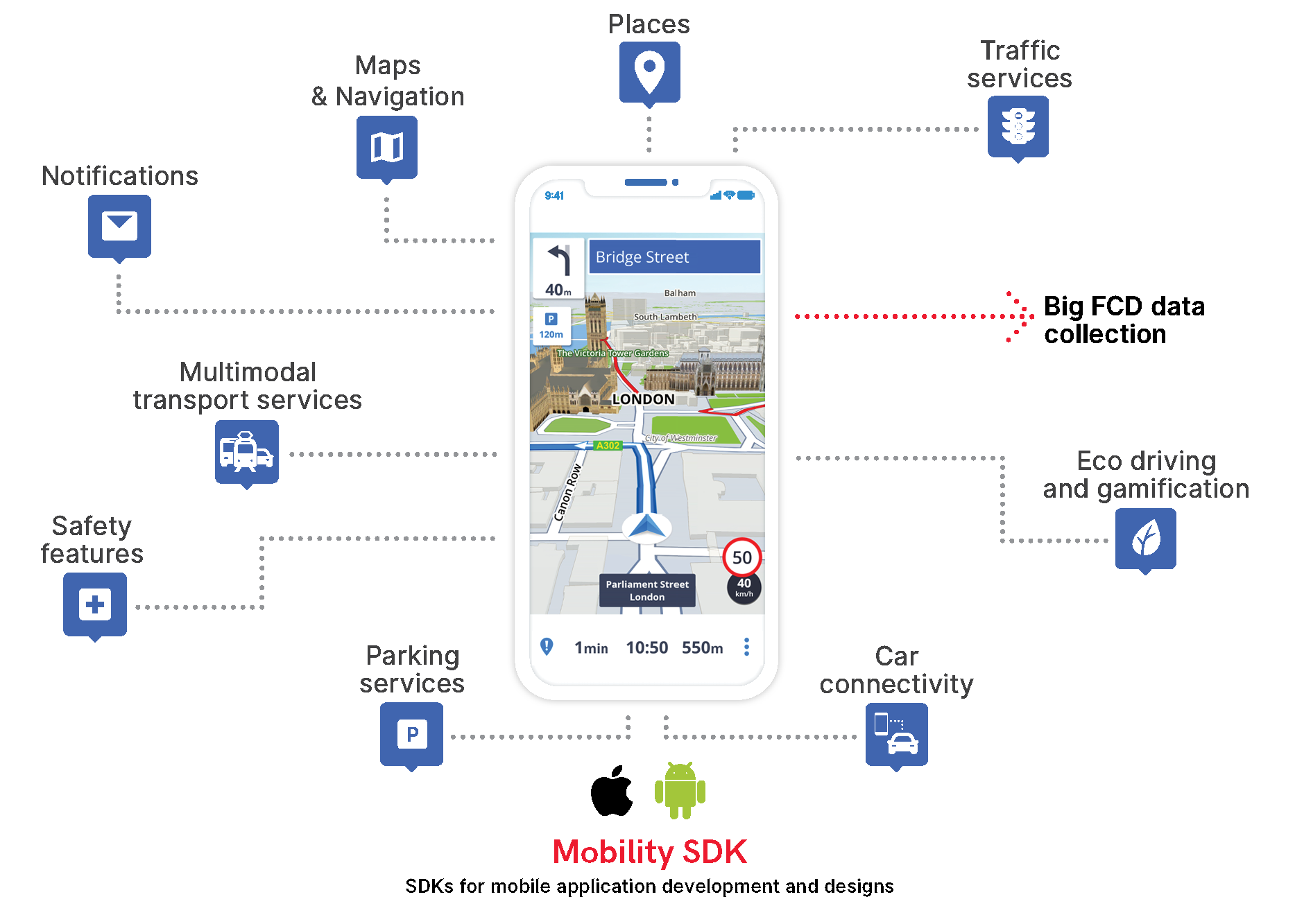
Sygic Mobile SDKs allows easy development of smart mobility application for citizens that can integrate all existing city transport services and can offer commuters a choice among all possible transport alternatives: car, public transport, taxi, bicycle, car share, ride share.
- fast development from existing Sygic SDK libraries
- Supporting all common operating systems (such as Android, iOS)
- Ready for real-time data integration
- Big data collection

Smart City Navigation System
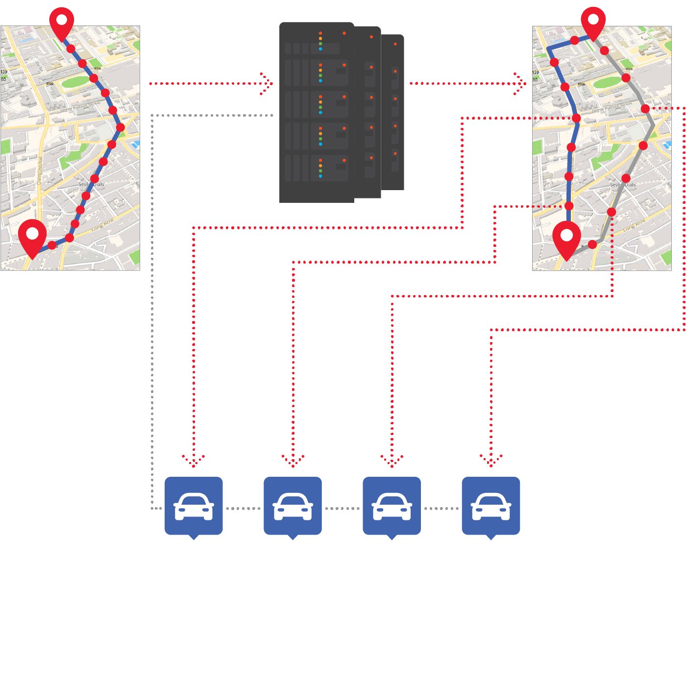
Algorithm to navigate thousands of drivers within a city area to mitigate traffic jams. By navigating a large volume of vehicles, the central system automatically calculates the current load of the transport infrastructure and predicts it up to 30 minutes ahead. In other words, the system sees the future and therefore can recalculate the drivers’ routes to avoid traffic jams.
- Data fusion from floating car data, road sensors, inputs of incidents and the weather
- Traffic view and prediction
- Cooperative routing for congestion mitigation
Sygic uses a supercomputer to master such calculations relatively easily. We assume that this type of solution will come to a wider use with the advent of autonomous vehicles.

What-If Analysis
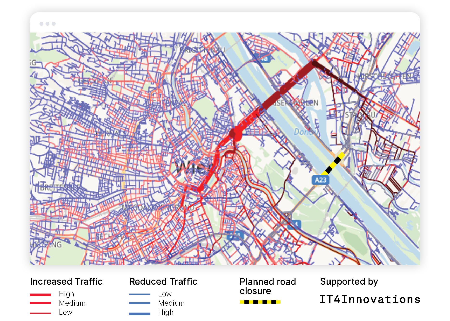
Analyse the quality and sustainability of a city's road infrastructure. Find answers to what-if questions, i.e. conduct analyses of situations that currently don’t exist, but can happen: what if a new residential complex is being built in a given location, what if a bridge must be closed, what if a serious accident occurs at a particular place?
- Infrastructure evaluation of mobility efficiency
- What-If Analysis of road closures and infrastructure changes
- Big Data-driven road infrastructure planning
Sygic uses high-performance computing and even enables the use of such simulators for real-time traffic prediction.

Traffic Prediction
Modern predictive algorithms combining historical speed profile data with real-time traffic data.
Algorithm inherently uses Sygic FCD data collected through the set of existing Sygic appllications, moreover, it is ready for fusion with data sources that cities have available, such as road sensors, camera systems, and public transport vehicle positions.

Public Transport Efficiency
Analyze and help improve public transport services. The optimal set up of time schedules, transit lines and stop distribution is difficult to calculate, but with the Sygic Smart Mobility Platform it is feasible. By combining multiple data sources from different data holders in the Sygic map platform (navigation app providers, mobile operators), it is possible to get a precise picture of the population’s mobility through the so-called origin-destination matrix and achieve true optimization.
- Car versus Public transport travel time and cost evaluation using real traffic data
- Public transport optimization of transit lines, schedules and priority lanes
- Optimized scheduling of bus shuttles based on online requests and vehicle occupancy
Suitable for dynamic public transportation based on continual real-time monitoring and prediction.

Other Popular Use Cases
Let's Talk
Need a quote?
Want to try out the solution?
Need expert guidance?
Fill out this form, and we'll get back to you as soon as we can.
Not here for business?
Hop into our Support Center.


